Cheaha Mountain
Alabama
November 2013
It was easy to find that Cheaha Mountain is the high point of Alabama. (Cheaha is pronounced “Chee-ha,” just like it looks.) It was easy to find that the summit is 2407 feet up. It was easy to see that this summit is in Cheaha State Park and that Cheaha State Park is part of the Talladega National Forest. And it was easy to see how to drive to the summit.
Our mission however, is to hike to the summit whenever possible and at first, because of the hundreds of miles of hiking trails in the Cheaha and Talladega areas, our expectations are high. With all these trails, it should be easy to plan a hike to the summit. This however, is where the easy ends. My first telephone call to Cheaha State Park goes something like this…
“I’d like to get some information about the hiking trails in your area.”
“I can’t help you with that but here’s another number you might could try.”
She gives me the telephone number, but y’know, folks in the South sometimes talk… real… slow. She says, “Here’s the number. 2 0 5…”
Pause… A long pause.
I wonder at this point, if I’m supposed to say, “2 0 5…” So I say, “205…”
It does prompt her but not in the way I had hoped. Instead of continuing, she confirms, “Uh-huh. 2 0 5…”
“Uh-huh.”
It’s been a while since I’ve eaten and I’m starting to get hungry. But I wait for the rest of it. Finally she says, “3 6 2…”
I say, “Uh-huh, 362. Okay. Go on.”
So just to make sure, she confirms again, “2 0 5… 3 6 2…”
Well, time for a nap. Is there an end to this number, or do I just figure that time has lost all meaning. I say, “Okay, I got it, what’s the rest of the number?”
Starting over one more time, she finally gets up enough steam to go all the way through with those last, precious four digits. Finally I am able to say, “Thanks. Bye.”
I dial the number she gave me and find that the area code — in case you didn’t get it, it’s “205” — is not the correct area code. Possibly the area code changed during the time it took for her to tell me what it was. That’s time I will never get back.
It’s not hard for me to find the correct area code, even though I don’t live there. I make my second call, this one to someone at a National Forest number. The woman who answers directs me to a website that, even though the government shutdown has been over for a week (this is late October 2013,) is still down. In fact, the National Forest Store, and the National Forest, are both still closed. I get a recorded message: “Due to the lapse in federal government funding, the U S Forest Service, as with other federal agencies, is nonoperational with the exception of certain essential services. We sincerely regret this inconvenience. For general information on Forest Service shutdown procedures, please visit USDA’s website.” Which is also closed.
They don’t think my Highpointing is an essential service? Louts, the lot of ‘em!
Undaunted, I call some half dozen other possibly appropriate numbers before I get a voice slowly asking for my credit card number. In return, she promises to send a map of the area of interest. I do like to see what I’m buying before the act but I guess I don’t have much choice this time. “What does this map cost?”
I don’t want to lay out twenty bucks for a map that might not be what we need. I’ve done that before and I get to feeling dumb.
She says, taking a good quarter of an hour, “It’s four dollars.”
I say, “Okay, I’ll take the plunge. Send it to me.” Taking four dollars for a map must qualify as an essential service. The government could certainly use my money.
The map arrives and I peruse it carefully. To my surprise, there are no hiking trails to the summit. Hundreds of miles of trails in the area and the only way to get to the top is to drive your vehicle or walk on the road. Clearly not everyone has their priorities where they should be, which is to say, where mine are.
I do notice what’s called the Pinhoti Trail. It’s 335 miles long and maybe, just maybe, one section of the trail might get us to the summit. It climbs right over the top of Cheaha Mountain, but curiously, as I look carefully, it does not connect with any trail that leads to the summit. This one gets the big Nope. Pinhoti means “turkey’s home.”
I’m nothing if not persistent. I try yet another state park telephone number. I say, “We’re going to be coming to visit your area and we’d like to hike up to the summit of Cheaha Mountain. I’m looking at your map but I’m not seeing any foot trails that go directly to the summit.”
She says, “What do you mean, “the summit?”
Oh boy. Good thing for me that I’m a teacher. This has enabled me to develop the power to keep my mouth shut when the sarcasm inside me is surging to get out in a raging storm of well-deserved insult. Instead, I respond by saying, “Y’know, the top…?”
“You want to go to the top?”
“Uh, yeah. The top.”
“Why don’t you just drive?”
“I want to hike.”
“You want to hike?”
“Uh, yeah. I want to hike to the top.”
“Well, where do you want to hike from?”
I’m thinking, “Well, y’know, Pittsburgh.” I’m thinking, “Well, y’know, the bottom.” I’m thinking, “I know Alabamans have a different accent than Pittsburghers, but apparently y’all have a different language. And it’s one that makes no sense!”
What I do say is, “Well, y’know, I’m not sure yet. I’m trying to find a good trail on the map, one that would take us to the top.”
“Are you coming from **click**click** [dead]
Seriously?
I wait a few moments and call back but the telephone does not get answered. I go for a walk and call again. This time, the same woman comes back on the line. I say that we must have gotten cut off but would it be okay to continue our conversation? (What am I, nuts?)
She says, “Yeah, we did get cut off. We can still talk.”
But at this point, I’m damned if I can think of what to talk about with her. So we hang up and I give it just one last try. This time to the Alabama Hiking Trail Society. The name gives me the impression that these folks may know a thing or two about hiking and possibly they like helping other hikers. (Why? Why? Why?) The AHTS fails to return my calls. I leave four messages over a week. As of this writing, months later, they still haven’t returned my calls. I’m sure they are all out on the trail. Or something.
By now, there is only one person I can trust because I know exactly how reliable his information is. That person is me. I’ll get a United States Geological Survey topo map and lay out some hiking routes and we’ll figure it out from the information we have and what we discover once we are there.
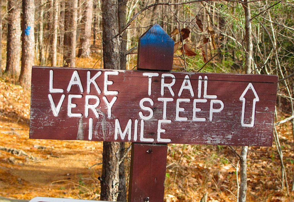
I settle on the Lake Trail. It’s a short steep hike but it looks like it will serve better than any other trail I can find. Yep, if anything will, this one’ll do it. To the summit! You know, the top.