Colorado
June 2018
First, let’s get the name straight. They don’t call it “Pikes Peak.” They call it “Pikes Peak America’s Mountain.” Or at least the P R people call it that.
Next, Pikes Peak America’s Mountain is…
– the second most-visited mountain on the planet. For 50 points, which one is first? Right! Mount Fuji in Japan, according to, once again, the P R people at Pikes Peak. I mean Pikes Peak America’s Mountain. Lots of folk disagree. Ever been to Mount Washington in New Hampshire? Quick unreasonably crowded.
– the mountain that inspired America the Beautiful. Actually it was a poem, not the mountain, with the title Pikes Peak, written by Katharine Lee Bates, that inspired America the Beautiful.
– home to Santa’s workshop — which is at the base of the mountain. We drove past it. I don’t know anything.
Pikes Peak is very high. The top is 14 115 feet above sea level. Lisa and I arrive by car at the parking lot at 12 780 feet which makes the rest of the journey a perfect afternoon hike to the summit.
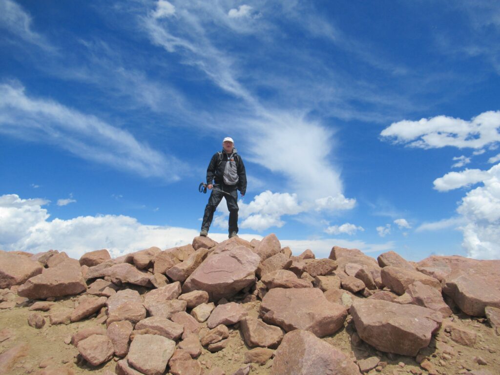
It’s not an easy trail, steep in places, hand over hand climbing on the rocks, plus the altitude is challenging. At the summit, air pressure is 1/5 what we flatlanders are used to, so we stop from time to time to suck in an amount of air as best we can.
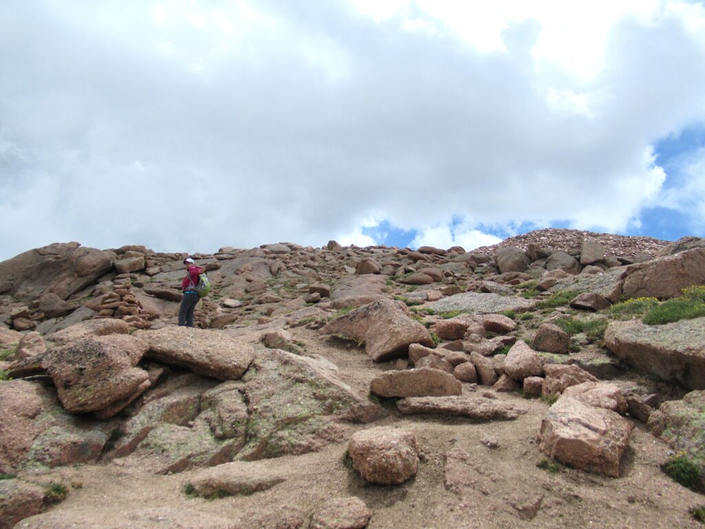
The trail to the summit from this parking area is unusual in several ways. Trailhead, as well as our parking lot, is at an area called Devils Playground. Yah. This area is one of the most electrically active zones in the world, registering thousands of lightning strikes each year. Because of the terrain and ground composition and exposure and elevation, and probably a dozen other things, lightning jumps from rock to rock during thunderstorms. Or maybe, as some say, it is simply a phenomenon that only Old Scratch himself could bring.
The sky during our hike was clear and sunny with little chance of thunderstorms. We did not see the devil playing.
Shuttle buses travel up and down Pikes Peak Highway from the Devils Playground parking lot, at mile 16, to the summit. Most people drive up this far, park their cars and then take the shuttle the rest of the way. There are numerous bicycle tours as well, and sometimes riders depend on the shuttles to carry their bikes, and their sorry asses, when they realize that they’ve committed to way more than they expected. An elevation gain of 1335 feet is a lot to crank out on a two-wheeler. On the other hand, you can get up to 500 miles per hour coasting down the mountain.
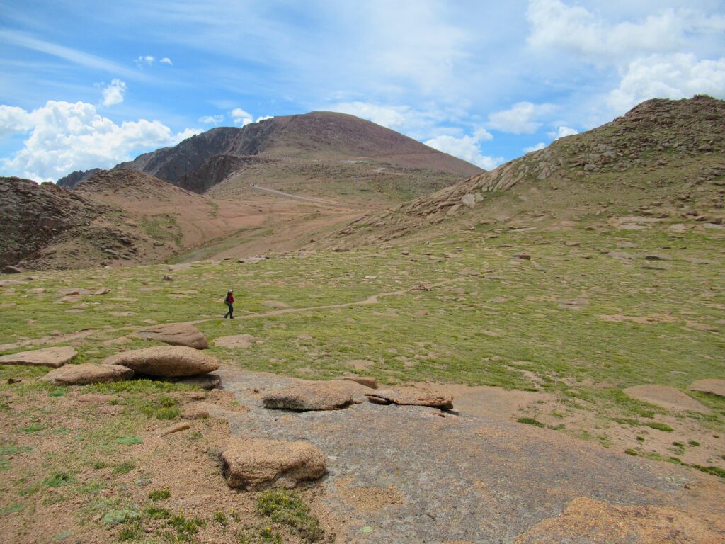
Our hiking trail more or less parallels the highway. So for us, one unique thing is that if we choose, and we are willing to admit that our asses too are sorry, we can hike up to the summit and take the bus back. Let’s talk luxury!
Another oddity are the outhouses placed every so often, comfort stations easily accessed from the trail. We are not used to this.
You get up into quintuple digits of altitude in feet and you can count on the wind. That is, it will be blowing. No exception here. The outhouses are strapped down using tough polyester webbing. Doesn’t matter. Inside the place is rockin’!
We are greeted by a few friends, folks who live here.
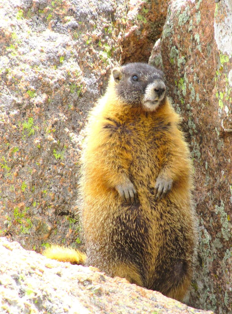
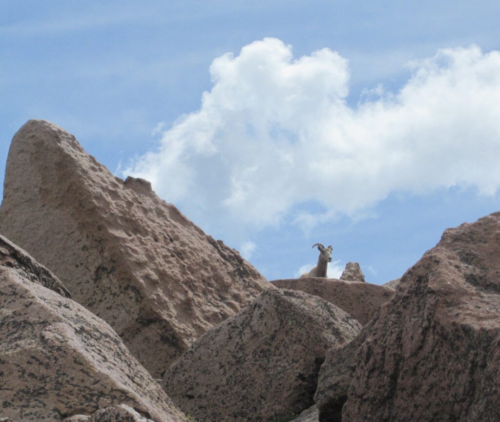
We receive early warning of another local resident…
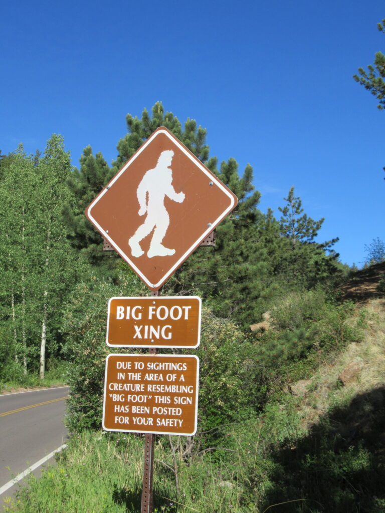
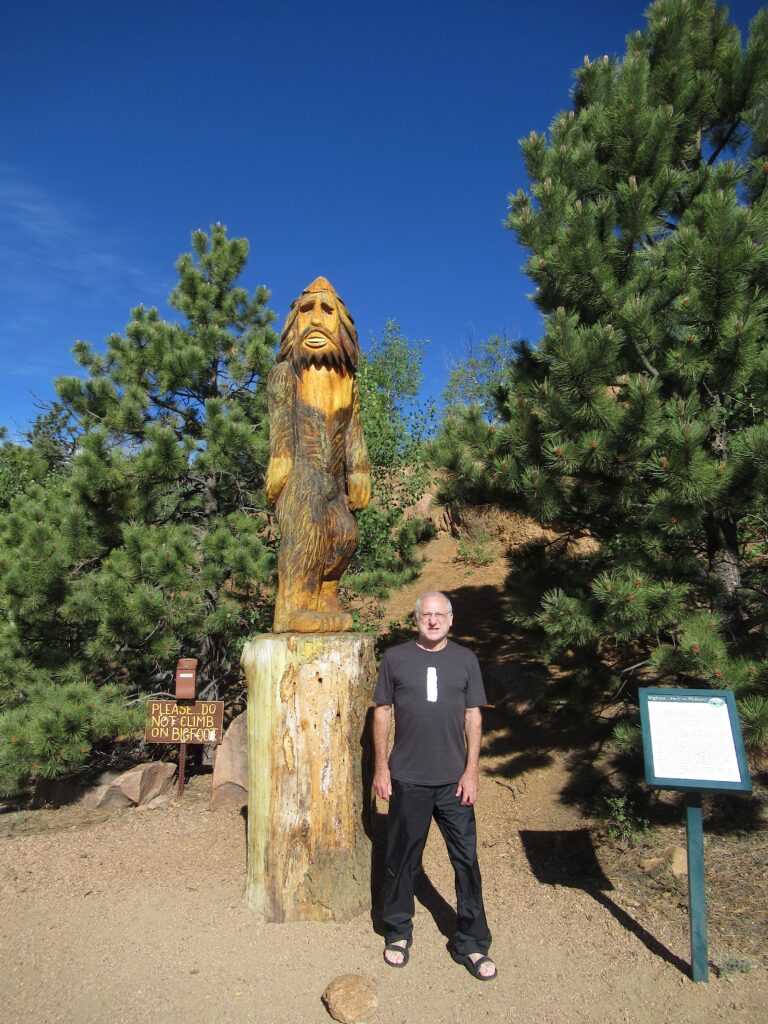
…whom we actually meet at the Halfway Picnic Grounds on the 19-mile, winding two-lane road that ends at the summit.
Once on top, there is a continual waiting line of visitors anxious to get their photo taken with the big shot.
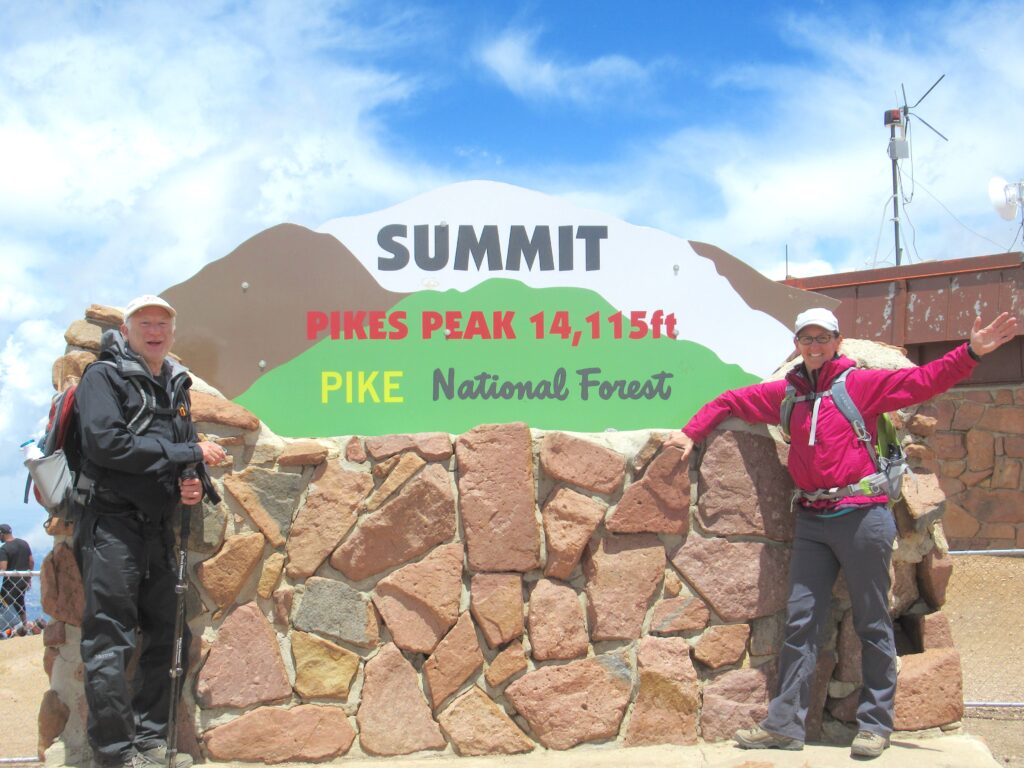
Looking around however, I notice, blessedly away from the crowds, a large low mound of rock. Looking at the sign, looking at the rock, looking at the sign, looking at the rock… Yeah. I’m pretty sure the rock is higher. I surmise that this rocky sector, 235 x 300 feet, might be what the entire summit once looked like, before civilization moved in. Now it is surrounded by the parking lot with buildings and out-buildings dotting the perimeter.
And here we are, at the actual high point, 345 feet southwest of the sign, and 345 feet southwest of where just about everybody thinks it is, and 14 115 feet straight up from where the sea would be if the sea were here.
The gift shop seems to be as big an attraction as the summit itself. We wander around inside, trying to decide if we want our Pikes Peak America’s Mountain souvenir to be a mug or a bandana. Lisa does more wandering than me. The interior is hot and I don’t last more than two minutes before I feel the altitude. I am lightheaded, overheated, suddenly feeling generally crummy. I step outside and feel better almost instantly. I try again and go inside the building, but in no time at all, the symptoms return. Outside again, looking at the 100-mile view, reasoning that outside is not significantly lower in altitude than inside, I decide that my symptoms are not from the thin air but rather from the density of human flesh crowding one another in the store. Soon’s I get out of the shopping environment, I’m better.
Take some photos, be amazed at the view, time to ride down to our car. We climbed up and now feel like relaxing. On the bus, we see numerous posted warnings about what can happen to the brakes on your vehicle on the 6300-foot downhill drive to Gateway. To wit…
Hot brakes can fail. Drive down the mountain in low gear or low range. Let your transmission do the work. Save your brakes. If you are unsure how to use your low gears, ask a Ranger for help.
Use your transmission to do the work? Reminds me of when we were relatively new drivers, in our early 20s, some of us with our first cars. A number of us had manual transmissions, stick shifts. In those days of utmost awareness and sensitivity of our personal social status, it was cool to downshift when slowing down, rather than using the brakes, the same ones our very square parents used. The sound of the revved up engine was cool.
Somewhat later in life, I heard a segment on Click and Clack where the caller asked about this practice. Their response was simple. “What does a new transmission cost? Thousands of dollars. What do new brakes cost? Hundreds of dollars. You do the math, Mario.”
Anyway, having ridden back to trailhead on the bus, we are now driving our way down from the parking lot at Devils Playground, trying to go slowly and not burn up our brakes, taxing the car’s transmission. At mile 10, six miles below the parking lot, we come to an entry station. A couple of friendly uniforms are checking in with drivers. One of them pulls what looks like a metal tire pressure gauge from his shirt pocket. He bends down to where we can’t see him and then straightens up. I see a guy doing the same thing with the car ahead of us. He waves something by the rim of the wheel.
Our guy says, “134.” The other guys says, “Two ten.” I wonder if they are relaying coordinates for the current location of Bigfoot.
I ask, “What’s going on here? What are you talking about?”
“Measuring the temperature of your brake rotors. Yours is 134 degrees. That guy’s is a little higher. If it were up over 300, we’d pull you over until your brakes cooled down considerable. Don’t want anyone going over the side.”
Going over the side would be so easy on this narrow, hairpin-laden highway. We agree that not going over the side is a most excellent idea for so many reasons. It’s America’s Mountain, but going over the side is not the way to see it.
Wait a minute, one more thing to clear up. We’ve seen various references to Bigfoot, more than odds would predict. I ask the guy at the Halfway visitor center. “Yah, what’s the deal with Bigfoot?”
He explains, “The number of sightings has increased dramatically since 2012, when they legalized marijuana in this state.”