Shenandoah National Park
Whiteoak Canyon Trailhead
May 2023
Some recreational areas place signboards at trailhead. These vertical information centers inform you of what to expect on your hike: route finding, elevation, distance, landmarks, hazards, attractions and maps.
As we approach this particular trailhead, and therefore a signboard, we encounter a woman with a furrowed brow, staring at the posted information.
“Hello.”
“Hi.”
So far, so good.
“Good day for hiking, huh.”
“It’s always a good day for hiking.”
“Yeah. A bad day on the trail is better than a good day in the city.” A kindred spirit.
She clearly has some miles under her belt (should I say, on her boots?) as her hair is white and her skin… has seen some weather. As we chat, it is clear that she knows her stuff.
“N’wait, what’s this? Look here, a formula under the heading, ‘The Math.’ A formula? I’ve never seen that before.”
“Me neither.”
Some hikes are tougher than others; you know this, of course. But how much tougher? Can we measure hike toughness?
It explains on the information board that Shenandoah’s Hiking Difficulty is determined by a numerical rating using the following formula:
__________________________________________
√ elevation gain in feet x 2 x length of hike in miles
Which is to say, take the elevation gain in feet, multiply by 2, multiply that by the length of the hike in miles and take the square root of that quantity.
A fair amount of my time was wasted in the mathematics department in college and in fact, I majored in math for a while. I put in enough energy there to have some idea of how some numbers actually relate to real life.
Like for instance, pluck a string and note the note it produces. (“Note the note.” See? It already has the rhythm of a chant.) Now double the length of the string, pluck it again and notice that the tone is exactly the same only one octave lower. Yow! Ain’t that cool!
Or how about sending up a rocket ship. Traditionally you’ve got to send up fuel with the rocket. How much fuel? Whatever it takes to life the weight of the rocket. Plus the weight of the fuel. But when you add the weight of the fuel, you are obviously adding more weight to the whole package so now you’ve got to add more fuel to lift the added weight. This goes on: more fuel implies more weight which leads to more fuel. In math class, we figured out the formula that works for this wacky, tangled dilemma of balancing the weight of the fuel against the thrust it can generate.
In our present equation, you’ve got a square root. In real life, I have no idea. I mean, we all know that the square root function is a function that maps the set of nonnegative real numbers onto itself. Right?
Nevertheless, take the product of the equation and find it on the following Shenandoah’s Hiking Difficulty rating scale. If your legs don’t know this on their own, you can still know this in your mathematical head. The numbers tell you so.
| 0 – 50 | easy |
| 51 – 100 | moderate |
| 101 – 150 | moderately strenuous |
| 151 – 200 | strenuous |
| 200 + | very strenuous |
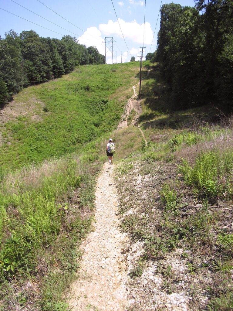
Real life: One of our prettier, easy hikes around town is the Fall Run Trail, a more-or-less straightforward hike in the gorge formed by Fall Run, between the communities of Glenshaw and O’Hara Township.
The guy who lived next door to me in the college dorm was named Glen Shaw. He was not a mathematician.
The distance from one end of Fall Run Trail to the other is 1.5 miles, total elevation change comes in at 178 feet.
Applying the Shenandoah Hiking Difficulty rating scale, this hike is the square root of [178 x 2 x 1.5.] Process the calculation and we have a hiking difficulty of 23.1. According to the scale, this is an easy hike. (We knew that.)
Now, take the ass-kicking hike to Half Dome from Happy Isles in Yosemite National Park in California. We did this hike in September of 2011.
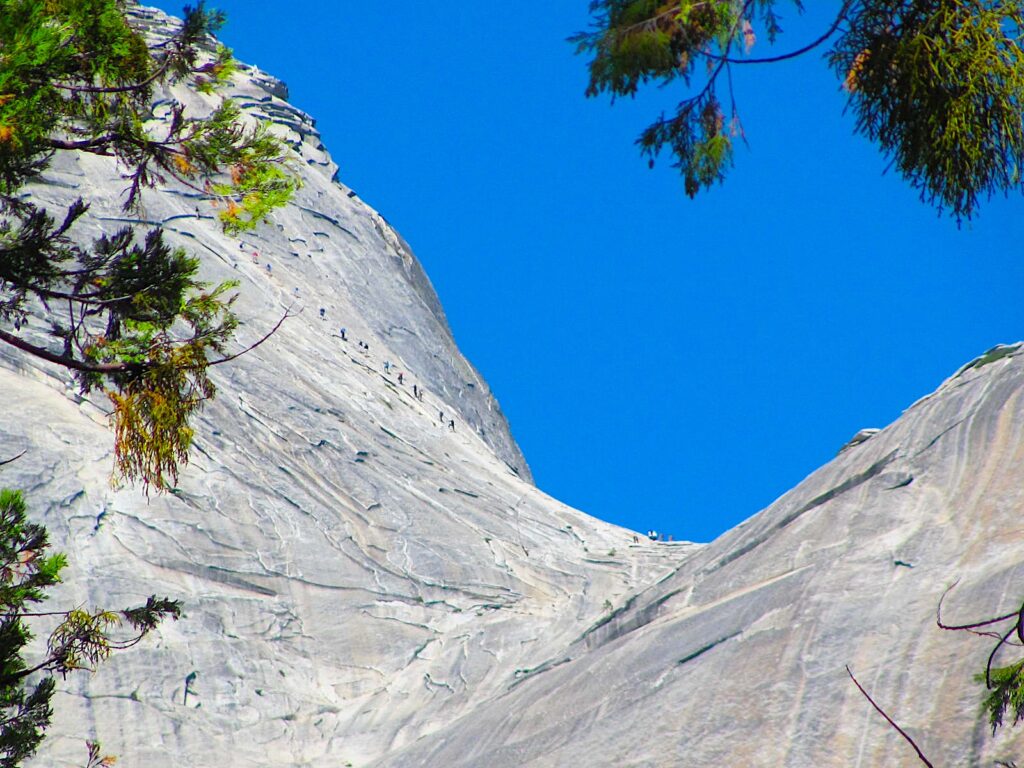
The stats play out this way…
| elevation gain in feet | 4000 |
| multiply by | 2 |
| multiply by the length of hike in miles | 17 |
The product is 136 000. Take the square root, which yields 368.8, and that is our Shenandoah Hiking Difficulty.
368.8! But 200 is as high as the scale goes, with that little plus sign. If you were to do this hike, I’m sure you would agree that one lousy plus sign just doesn’t do it. I mean, crashed a 368.8!
I hereby submit a new category for a hike of extreme toughness. We shall call it…
“200++” and we shall name it “ass kicking.”
Many years ago, my friend Mike founded an organization called the Western Pennsylvania Field Institute. WPFI was a nonprofit group dedicated to promoting outdoor recreation. (It soon changed its name to Venture Outdoors and they are still serving the outdoor community.)
At the time, for fun, and one of many topics we covered on our hikes together, we invented, but never fleshed out, a hike rating system. We would award points — WPFI points — depending not just on hike distance and elevation change as does Shenandoah’s Hiking Difficulty scale, but on weather conditions including rain, sleet, hail, barometric pressure, lightning, wind, snow, dust, amount of daylight, type and condition of footpath (on the Rockworth Scale, which I made up,) number of annoying hikers on the trip, weight carried, accuracy of maps and sometimes the amount of Jägermeister we drank around the campfire the night before.
You could probably guess why we never fleshed out this system.
Let’s calculate some more using the Shenandoah’s Hiking Difficulty scale, on these hikes that Lisa and I have done over the years.
Eagle Mountain, the high point of Minnesota
| elevation gain in feet | 566 |
| multiply by | 2 |
| multiply by the length of hike in miles | 7.0 |
level of difficulty 89.0 – this hike fits in the moderate category but it’s a case where you are going with only the elevation change and distance while ignoring all those important factors Mike and I came up with in assessing the level of difficulty or ease. For example, this trail is not smooth dirt but rather one must make way over rocks and boulders and tree roots, all of which add up the WPFI points but not Shenandoah points.
Humphrey’s Peak, the high point of Arizona
| elevation gain in feet | 3348 |
| multiply by | 2 |
| multiply by the length of hike in miles | 9.5 |
level of difficulty 252.2 – ass-kicking
Britton Hill, the high point of Florida
| elevation gain in feet | 1 |
| multiply by | 2 |
| multiply by the length of hike in miles | 0.0162879 (86 feet) |
level of difficulty 0.18049 – this hike comfortably fits the easy category; you could hike 277 times the difficulty of this hike and still be in the easy category
Mount Washington, the high point of New Hampshire
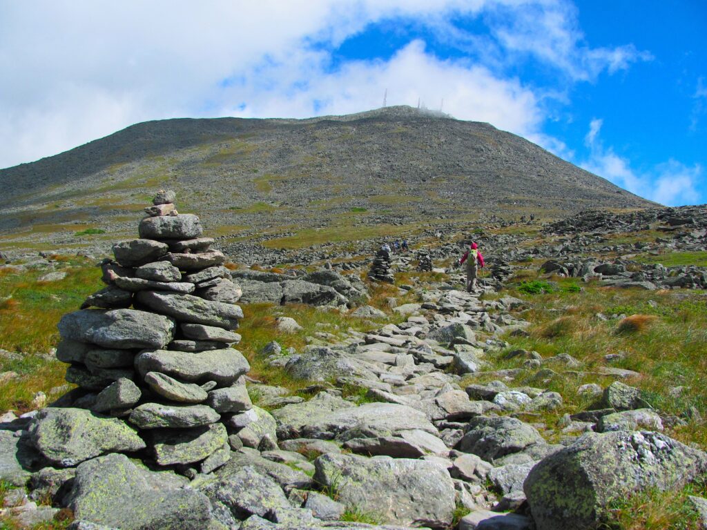
| elevation gain in feet | 3719 |
| multiply by | 2 |
| multiply by the length of hike in miles | 9.0 |
level of difficulty 258.7 – this means that climbing Mount Washington is only slightly more demanding than climbing Humphrey’s Peak in Arizona. But of course, Humphrey didn’t have 85 mile per hour winds and open exposure like we encountered on Mount Washington.
hike up to my third floor office
| elevation gain in feet | 18.4 |
| multiply by | 2 |
| multiply by the length of hike in miles | 0.003143939 (16.6 feet) |
level of difficulty 0.34014 – there is no “easy peasy” category, however, the trail is comprised of two staircases and a short landing between
Mauna Kea, the high point of Hawai’i
| elevation gain in feet | 4596 |
| multiply by | 2 |
| multiply by the length of hike in miles | 6.0 |

level of difficulty 234.8 – fields of rock and dried lava provide the moonscape backdrop on the way to the top
Rachel Carson Trail
| elevation gain in feet | 7671 |
| multiply by | 2 |
| multiply by the length of hike in miles | 45.7 |
level of difficulty 837.4 – hikers do actually hike this trail from one end to the other
Fun. Now, if you ever figure out what the square root of hiking might be, spread the word.